
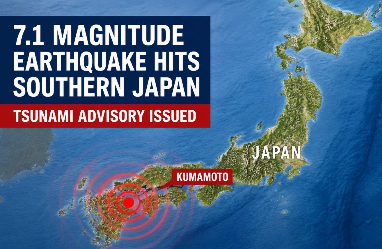
A powerful magnitude 7.1 earthquake struck southern Japan on Tuesday afternoon, producing the strongest level of shaking on the country’s seismic scale and prompting a tsunami advisory for coastal areas of Kyushu.
The earthquake hit Kumamoto Prefecture at 4:27 p.m. local time on July 28. The Japan Meteorological Agency placed the center of the quake in the Kumamoto region at a shallow depth of about 10 kilometers, or 6 miles.
As I write this, Japanese authorities have not released a confirmed total for casualties or major structural damage. The situation remains active, and the first information from affected communities may change as emergency crews complete their checks.
The first reports from Japan said emergency earthquake warnings were issued across Kumamoto, Nagasaki, Kagoshima, Fukuoka, Saga, Oita and Miyazaki prefectures.
Tsunami Advisory Issued for Two Coastal Areas
The Japan Meteorological Agency issued a tsunami advisory for the Ariake Sea and Yatsushiro Sea. Waves as high as 1 meter, or 3.3 feet, were considered possible.
A one-meter tsunami may sound small compared with the catastrophic waves associated with major disasters. It can still produce powerful currents, flood low coastal areas and sweep people or small boats into the water.
Residents were told to leave the water and stay away from beaches, ports, river mouths and other coastal locations until officials cancel the advisory. Tsunami waves can arrive more than once, and later waves can be higher than the first.
The Japan Meteorological Agency’s tsunami system uses earthquake data to estimate which coastal areas could be affected and how high the waves may become.
The Pacific Tsunami Warning Center said the earthquake did not create a tsunami threat for Hawaii or American Samoa. Readers concerned about alerts across the Pacific can also see our guide to tsunami warnings and preparation in Hawaii.
Shaking Reached Japan’s Highest Intensity Level
The earthquake registered a maximum intensity of seven on Japan’s Shindo scale in Kumamoto. Level seven is the highest possible reading on that scale.
Magnitude measures the energy released by an earthquake. Shindo measures how strongly the ground shakes at a specific location. A level-seven reading means people may be unable to remain standing and unsecured furniture can move or fall.
Buildings designed under older construction standards may suffer serious damage during shaking of that strength. Roads can crack, slopes may fail and utility lines can be disrupted.
The shallow depth also matters. Earthquakes close to the surface can cause stronger local shaking than deeper earthquakes of a similar magnitude.
What We Know So Far
| Detail | Latest confirmed information |
|---|---|
| Date | July 28, 2026 |
| Time | 4:27 p.m. local time |
| Location | Kumamoto Prefecture, Kyushu |
| Preliminary magnitude | 7.1 according to the Japan Meteorological Agency |
| Depth | About 10 kilometers |
| Maximum shaking | Shindo 7 |
| Tsunami advisory | Ariake Sea and Yatsushiro Sea |
| Possible wave height | Up to 1 meter |
Different earthquake agencies may publish slightly different magnitude estimates during the first hours after a quake. Measurements can be adjusted after scientists receive more data from seismic stations.
CBS News reported that the quake reached Shindo seven and confirmed that no tsunami threat was expected for Hawaii or American Samoa.
Residents Should Prepare for Aftershocks
Strong aftershocks commonly follow a major earthquake. Some can cause further damage to buildings, roads and hillsides already weakened by the first shock.
People in affected areas should avoid damaged structures and watch for broken glass, falling roof tiles, gas leaks and exposed electrical wires. Anyone near a steep slope should remain alert because strong shaking can loosen soil and increase the threat of landslides.
Officials also advise wearing shoes indoors where glass or other objects may have fallen. During a power failure, electrical equipment should be switched off to reduce the risk of fire when service returns.
People near the coast should follow local evacuation instructions rather than returning when the water appears calm. An advisory remains active until the authorities formally lift it.
Kumamoto Was Hit by Deadly Earthquakes in 2016
Tuesday’s earthquake carries particular significance in Kumamoto, which experienced a devastating earthquake sequence in April 2016.
A magnitude 6.5 earthquake struck the region on April 14 of that year. A larger magnitude 7.3 quake followed about 28 hours later. Both produced level-seven shaking in parts of Kumamoto Prefecture.
The Japan Meteorological Agency’s record of the 2016 Kumamoto earthquakes shows how a major later quake can follow an initial strong shock. That history is one reason authorities are likely to treat the current aftershock risk seriously.
People should not interpret that comparison as a prediction that another larger earthquake will occur. Scientists cannot reliably predict the exact time, location and magnitude of an earthquake.
Claims about precise earthquake dates have repeatedly circulated online. We previously examined unsupported predictions about a major Japan earthquake and explained why official warnings should be trusted over viral posts.
The Full Impact Is Not Yet Clear
The earthquake occurred only a short time before the first reports were published. Emergency teams still need to inspect homes, bridges, railways, power systems and coastal facilities.
No confirmed casualty total had been announced at the time of publication. Early silence does not prove that no one was hurt. Communication problems often delay information from the areas that experienced the strongest shaking.
For now, the most urgent message is directed at people in Kumamoto and nearby parts of Kyushu. Stay away from the coast, expect aftershocks and follow instructions from the Japan Meteorological Agency and local emergency officials.